Worldwide Sites

You have been detected as being from . Where applicable, you can see country-specific product information, offers, and pricing.

Change country/language X

Keyboard ALT + g to toggle grid overlay

WDI STUDIOS PVT. LTD.

BIM tools visualize site development for 100-acre township in Malaysia.

Customer story

Image provided by WDI Studios Pvt. Ltd.

WDI Studios had just three weeks to interpret raw survey data, model civil works and visualize improvements to reduce site development costs.

WDI Studios, an architecture and interior design studio in Gurgaon, India, has integrated building information modeling (BIM) into its practice to reduce costs and deliver benefits to clients for corporate, residential, commercial and hospitality projects. As BIM consultant for a 100-acre township project near Kuala Lumpur, Malaysia, the firm had just three weeks to create visualizations that would aid stakeholders in making decisions about the site's development. WDI Studios saved days by using Autodesk Civil 3D®, Infraworks® and AutoCAD® to create accurate terrain models, model civil works, optimize cut-and-fill plans and visualize cost-saving options for parcel elevations.

Greenfield site development outside Kuala Lumpur makes housing and amenities affordable for Malaysia's middle class.

Beyond the borders of Kuala Lumpur, where twin towers of glass and steel dominate the modern skyline, lush rainforests and pristine beaches beckon tourists from around the world. For Malaysia's burgeoning middle class, the new townships on the outskirts of the capital city are a great draw. These greenfield sites provide much-needed housing for the M40 demographic, comprising the middle 40 percent of Malaysia's 32.4 million population. Adorned with desirable amenities, the privately developed townships also stimulate commerce in the greater metro area.

WDI Studios was in on the ground floor of a 100-acre development near Kuala Lumpur. The new township will provide luxury housing and schools, as well as amenities and attractions, including hotels, restaurants, and amusement parks.

"We were working in the conceptual development phase of the project, where our visualizations would give a clear idea of the design intent to multiple stakeholders," says Gaurav Sharma, BIM value consultant and director of technology for WDI Studios.

Given just three weeks to deliver, WDI Studios was responsible for interpreting raw site survey data, developing the required data sets in Autodesk Civil 3D and visualizing the site development plans in Infraworks.

The 3D walkthrough of roads and parcels intended for development by the architect allowed decision-makers to evaluate various design options for potential cost savings. WDI Studio's models then became the basis of design work by other project stakeholders.

Taking advantage of CAD tools with BIM capabilities

By allowing the owner to see various site development options early in the design process, WDI Studios helped to predict the impact of design changes, avoid unanticipated costs and lower the costs of preferred options. BIM capabilities saved almost 42.7 percent of the time in this initial phase compared to traditional methods.

Autodesk's integrated CAD tools supported a smart workflow, from inputting raw data to AutoCAD to creating finished topographies, optimizing cut-and-fill volumes and adjusting parcel elevations in Civil 3D. Civil 3D combined a complete set of 2D drafting tools with an intelligent 3D modeling platform that made the work fast and accurate.

The editable objects provided by Civil 3D could be finished with a high degree of detail. Once WDI Studios developed the plan profiles with alignments, centerlines and elevations in Civil 3D, they were imported to Infraworks for modeling of the road network.

Infraworks' storyboarding capability was used to create the visualization for stakeholders to act upon," Gaurav Sharma says.

Gaurav Sharma,Director of Technology, WDI Studios Pvt. Ltd.

Modeling civil works in less time, providing section views in minutes

Using BIM improved the site development planning process across the board. Aligning the township's traffic corridors was simplified, with multiple section views of highways and roadways available in mere seconds.

The procedures for achieving the desired horizontal and vertical alignments would have taken hours using traditional 2D tools. Civil 3D's complex computation engine also allowed WDI Studios to calculate cut-and-fill quantities in much less time.

Gaurav Sharma notes, "Determining current cut-and-fill conditions and improved cut-and- fill conditions would have taken days if computed manually."

Using BIM tools to collaborate saves time

The project's tight deadline was WDI Studio's greatest challenge. Gaurav Sharma confides that the process of sharing information wasn't the most efficient in the past. He noted a McKinsey study that found workers waste up to 60 percent of their time gathering requested information and communicating with coworkers, leaving just 40 percent of their time to spend on role-specific tasks.

To avoid these pitfalls, Gaurav Sharma leveraged his familiarity with Autodesk software to streamline workflows with Standard Operating Procedures for project execution.

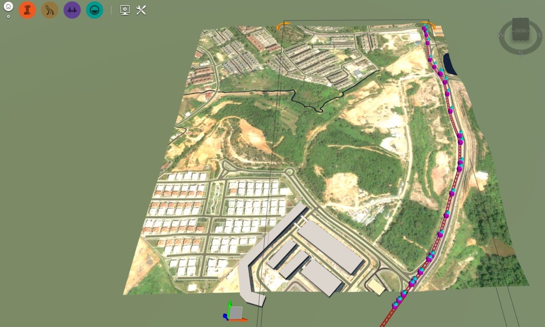
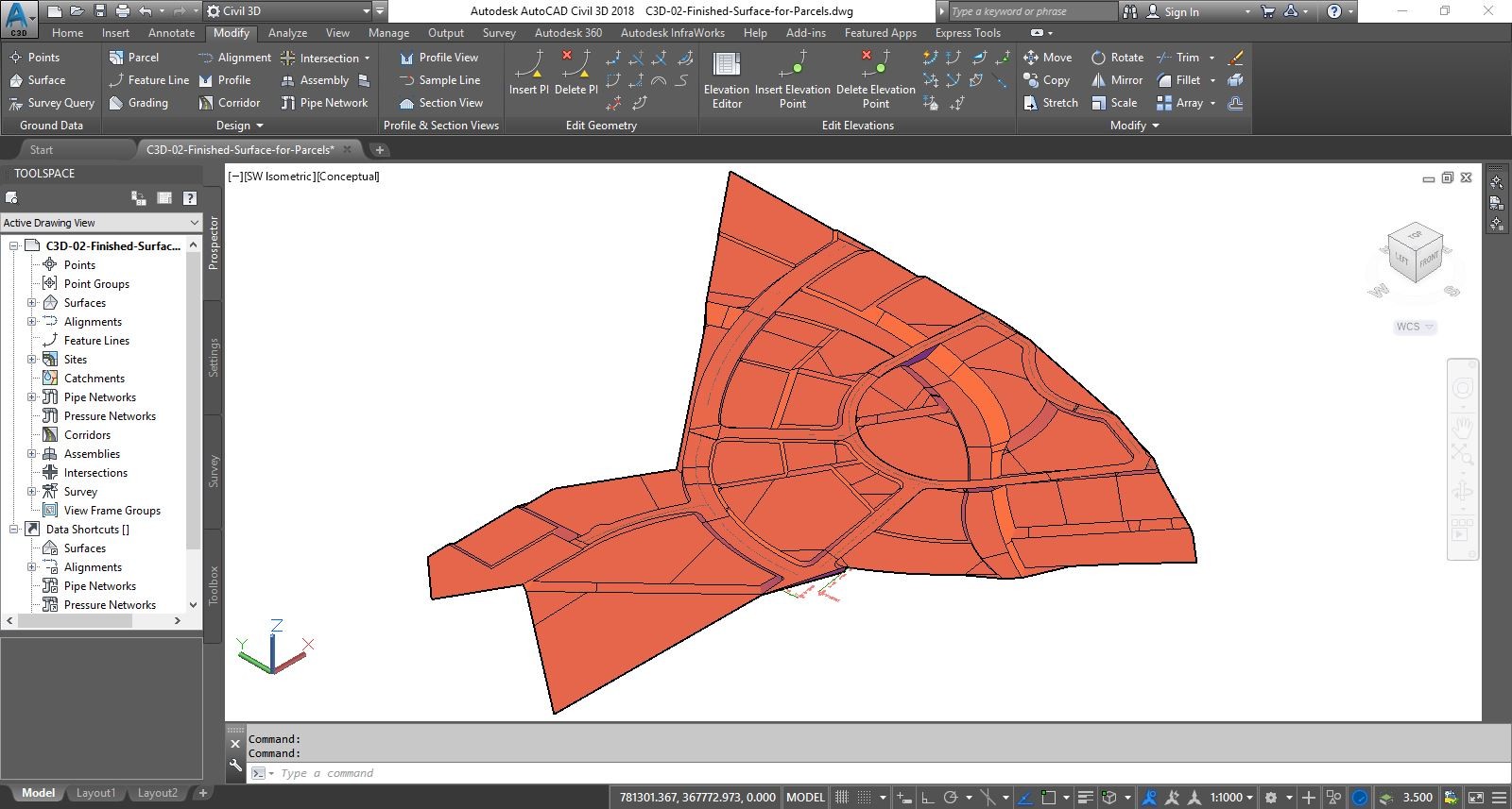
The use of previsualization techniques allowed the team to experiment with different design options before sharing them with stakeholders.

All of the models were put into descriptive layers, and more layers could be added. Data shortcuts provided a complete reference copy of an object that could be imported from one drawing into other drawings. This flexible, object-level technique eliminated administrative overhead and solved problems typically experienced when collaborating on drawings.

Autodesk's integrated toolset enabled WDI Studios to complete this phase of a complex site development project on time and on budget.

"The smart, familiar and efficient user interface is simply loved by our engineers," Gaurav Sharma says, "enabling them to focus on what they need to deliver projects effectively."

Related products

BIM for Civil Engineering

Use intelligent, connected BIM (Building Information Modeling) workflows to help improve the outcomes of your infrastructure projects.